I will do farm land map, agricultural map, property map, land survey map, gis map

C
clarencehen
C
clarencehen
Clarence Hender

About this gig

Hello Buyer

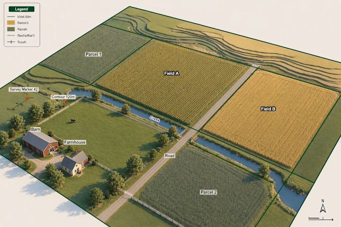
I create professional farm land maps, agricultural maps, property maps, land survey maps, and GIS maps. I turn raw survey data, coordinates, or satellite imagery into clear, accurate maps you can use for planning, records, or presentations.


I can create:

  • Farm and agricultural land maps
  • Property and parcel maps
  • Land survey maps
  • GIS maps (vector and raster)
  • Boundary and lot maps
  • Topographic maps
  • Cadastral maps
  • Soil and crop mapping
  • Satellite and aerial map analysis
  • Geo referencing and digitizing
  • Shapefile, KML, and GPX map creation


Why choose me:

  • Accurate, GIS verified data
  • Clean, professional map design
  • Fast turnaround
  • Clear communication throughout
  • Files ready for print, reports, or GIS software


A clear, accurate map helps you plan, manage, and present your land or property with confidence.

Please message me before ordering so I can review your requirements and recommend the right package.

Delivery style preference

Please inform the freelancer of any preferences or concerns regarding the use of AI tools in the completion and/or delivery of your order.

Get to know Clarence Hender

Clarence Hender

Site Plan Map Designer AutoCAD GIS Specialist

  • FromUnited Kingdom
  • Member sinceAug 2026
  • Avg. response time2 hours
  • Languages

    English
Hello Buyer, how are you doing today? My name is Clarence Hender. I specialize in creating accurate, professional Site Plans and Maps that bring your property, project, or land details to life with precision and clarity. Whether you need a detailed site plan for permits, construction, or presentation purposes, I deliver clean, well scaled, and visually appealing results tailored to your exact requirements. Let's bring your vision to reality message me today and get a site plan that saves you time, meets regulations, and impresses every viewer.