I am a GIS analyst and developer with a degree in geo-informatics. I have experience using a variety of GIS software, including ArcGIS, QGIS, and Erdas Imagine. I can also use web GIS and full stack web development technologies to create interactive and informative maps and applications.
Below are the major services, I'll be providing:
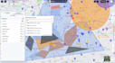
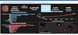
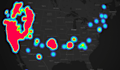
- Spatial Analysis
- DSM, DTM and DEM
- Coordinate System
- GIS Digitization
- Cartographic Maps
- Suitability Analysis Mapping
- Point, Line, Polygon, Raster to vector and vice versa
- Shapefile, Feature Class, Geodatabase, kml etc
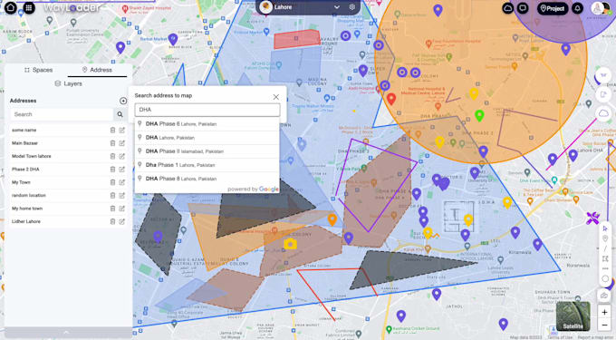
- Web-mapping
- Web embedding of maps and Geocoding
- OSM (Open Street Maps)
- MapBox
- OSRM
- ARcGIS Software Development Kits and API
- Leaflet
- MaqQuest
- Google Map APIs
- Topology
- Parcel Fabric Editing
- Road or Land Use maps
- Google Earth Mapping
- Merge/Buffer
- Site suitability
- Satellite image processing mapping
- Georeferencing, address Geocoding and reverse Geocoding
- Stereo Analysis
- Photogrammetric 3D Modelling