Browse categories
Explore
Fiverr Pro
English
$
USD


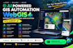
Need a powerful WebGIS application with interactive maps, satellite imagery, or AI-powered geospatial automation?
I develop custom GIS and WebGIS solutions that turn complex location data into interactive maps, useful insights, and efficient workflows.
WHAT I CAN DEVELOP:
Interactive web maps using Leaflet
AI-powered GIS automation workflows
Satellite imagery visualization and mapping
Custom WebGIS applications and dashboards
Geospatial data processing and spatial analysis
Map layers, markers, popups, filters, and search
GeoJSON integration and location-based tools
GIS data visualization and map customization
WHY WORK WITH ME?
I focus on building practical, user-friendly solutions tailored to your project requirements, whether you need a mapping MVP, a business dashboard, or a custom geospatial application.
LET'S DISCUSS YOUR PROJECT!
Send me a message with your project idea, data sources, preferred mapping features, and expected outcome. I'll review your requirements and recommend a suitable approach before you order.
Message me today to discuss your WebGIS project and turn your geospatial idea into a working solution.
GIS Development, GIS Analysis, Cartography, Web Mapping
Languages
What types of GIS and WebGIS applications can you develop?
I can develop interactive web maps, custom WebGIS platforms, geospatial dashboards, satellite imagery viewers, spatial analysis tools, and location-based applications tailored to your project.
Can you build interactive maps using Leaflet?
Yes! I can build Leaflet-based maps with markers, popups, multiple map layers, search, filters, GeoJSON data, and other features depending on your requirements.
Can you integrate AI into my GIS application?
Yes. Depending on your use case and available data, I can integrate AI-powered geospatial workflows for data processing, classification, analysis, and automation.
What do you need from me to start the project?
Please provide your project idea, required features, preferred mapping technology, available GIS datasets, satellite imagery sources (if applicable), and any reference applications or designs.
Can you customize an existing GIS map or develop a complete WebGIS application?
Yes. I can help improve an existing mapping application or develop a new solution from scratch. Please message me first to discuss your requirements, project complexity, and expected deliverables.
