Browse categories
Explore
Fiverr Pro
English
$
USD


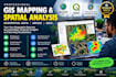
Need professional GIS mapping, geospatial data analysis, or spatial analysis for your project? I can help transform geographic data into accurate maps, meaningful insights, and clear visualizations using ArcGIS and QGIS.
MY GIS SERVICES INCLUDE:
WHAT YOU WILL RECEIVE:
I work with students, researchers, businesses, environmental professionals, and organizations that need reliable GIS solutions for research, planning, site selection, and location-based projects.
Whether you need a simple GIS map, detailed spatial analysis, or a customized geospatial visualization, I will tailor the work to your requirements
CONTACT ME BEFORE ORDERING
GIS Development, GIS Analysis, Cartography, Web Mapping
Languages
What GIS mapping and spatial analysis services do you offer?
I provide GIS mapping, geospatial data processing, spatial analysis, map digitization, data visualization, and geographic data conversion using ArcGIS and QGIS, depending on your project requirements.
What file formats do you accept for GIS projects?
I can work with compatible formats such as Shapefile, GeoJSON, KML, CSV, GeoPackage, raster datasets, and Excel files. Please contact me first if your data uses a specialized format.
Can you perform custom spatial analysis using ArcGIS or QGIS?
Yes. I can assist with suitable GIS tasks such as buffer analysis, overlay analysis, proximity analysis, site suitability mapping, and other geoprocessing operations based on your data and project goals.
Will I receive editable GIS project files?
Yes, editable project files can be included depending on your selected package and the software used. Please specify whether you need an ArcGIS Pro or QGIS project before ordering.
Can you handle large datasets or complex geospatial projects?
Yes, subject to dataset size, data quality, software compatibility, and project complexity. Please send your requirements and sample data so I can assess the scope and recommend the right package.
