Browse categories
English
$
USD
Connect to your AI


A WARM WELCOME TO YOU!!
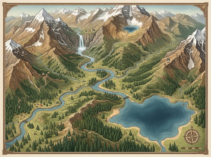
I create visually engaging and informative illustrated maps designed to help hikers, travelers, and outdoor enthusiasts explore natural landscapes with confidence. From mountain trails and hiking routes to national parks and outdoor recreation areas, I transform geographic information into attractive, easy-to-follow maps.
What I will provide
The Difference I Make :
let's create an exceptional outdoor adventure map together!
Message me today to discuss your project
Please inform the freelancer of any preferences or concerns regarding the use of AI tools in the completion and/or delivery of your order.
Map designer
Languages
What types of hiking maps do you design?
I design illustrated hiking maps, mountain trail maps, trekking maps, backpacking maps, national park maps and outdoor recreation guides.
Can you illustrate mountains, forests, rivers and natural landmarks?
Yes! I can incorporate mountain ranges, forests, rivers, lakes, campsites, viewpoints and other outdoor features.
Can you create a map using my existing GPS routes?
Yes. You can provide GPX, KML, coordinates or other available route information for accurate map representation.
Can I request a custom illustrated style?
Absolutely. You can share your preferred colors, visual references, branding and illustration style.
Do you provide print-ready files?
Yes. I can deliver high-resolution PDF, PNG, SVG and other agreed formats.
Can you design maps for national parks and tourism destinations?
Yes. I create customized maps for parks, resorts, tourism organizations, outdoor attractions and recreational destinations.
Can you show elevation, trail difficulty and distance?
Yes. If you provide reliable source information, I can incorporate elevation profiles, trail distances, difficulty levels and route markers.
Should I contact you before placing an order?
Yes! Please send me a message before ordering so we can discuss your project, map requirements, available geographic data and expected deliverables.