I will make topographic survey, land surveying map, contours map, from point topo dat

D
denireza
D
denireza
Reja

About this gig

Convert Your Topographical Data into Civil 3D drawing.

Create 3D Surface from Surveyor Data, GPS Points, etc.

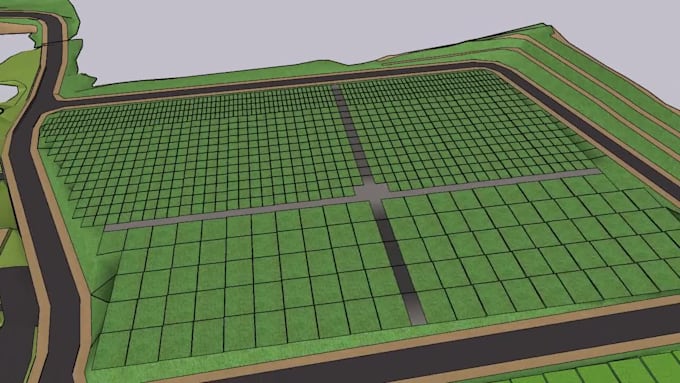
Draft the Existing Site Plan.

Create Existing Surface/Terrain Model with Contours.

Create Depth Contours

Create the proposed Driveway.

Create Longitudinal Profiles for Roads.

Create Cross Sections.

Volume Calculations for Land Development, Cut Fill, Earthworks.

Civil Drafting with AutoCAD, Civil 3D.

Prepare production plan border and title block as requested.

Prepare grading plan, precise grading plan, street plan

Prepare utility plan, anything in between

Delivery style preference

Please inform the freelancer of any preferences or concerns regarding the use of AI tools in the completion and/or delivery of your order.

Get to know Reja

Reja
  • FromIndonesia
  • Member sinceMar 2020
  • Avg. response time1 hour
  • Languages

    Indonesian, English
Using AutoCAD Civil 3D has been one of my main strengths, enabling me to efficiently build digital topographic models, analyze land contours, and perform volumetric excavation and fill calculations with a high degree of accuracy. These skills help me optimally plan cutting and additions, optimize resource use, and reduce waste. My commitment to quality and timeliness is also the main foundation in every project I handle. I believe that meticulous detailing and hard work are the keys to success in creating sustainable, high-quality designs.