Browse categories
Explore
Fiverr Pro
English
$
USD


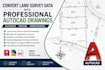
Do you need your land survey field data converted into accurate and professional AutoCAD drawings?
I specialize in transforming raw survey data into clear, precise, and industry-standard CAD drawings for engineers, surveyors, architects, and property developers.
My Services Include:
Convert land survey data into AutoCAD drawings
Boundary survey drafting
Topographic survey plans
Site plans and plot plans
ALTA survey drafting
Contour mapping
Parcel maps
Existing conditions plans
PDF/Image/Sketch to AutoCAD conversion
Revisions and modifications
Why Choose My Service?
Accurate and detail-oriented drafting
Fast delivery
Professional-quality output
Editable DWG and PDF files
100% client satisfaction
What I Need From You:
Survey field data / CSV / coordinates
Hand sketches, PDF, or reference files
Specific drafting requirements
Preferred output format (DWG/PDF)
I will ensure your survey data is converted into clean, accurate, and professional AutoCAD drawings ready for submission or project use.
Please contact me before placing your order.
Please inform the freelancer of any preferences or concerns regarding the use of AI tools in the completion and/or delivery of your order.
john
Languages
