Browse categories
Explore
Fiverr Pro
English
$
USD

Are you looking for reliable, accurate GIS analysis or remote sensing work? You're in the right place.
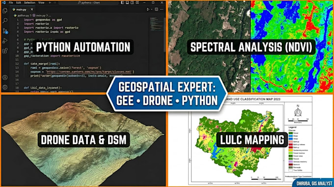
I'm a Geoinformatics M.Tech graduate with hands-on experience in spatial data processing ,GIS tools, satellite imagery analysis, and GIS automation using Python and Google Earth Engine.
What I can do for you:
️ GIS Analysis
️ Remote Sensing
Google Earth Engine (GEE)
Python GIS Automation
Drone Data Processing
Message me before ordering
GIS AND REMOTE SENSING EXPERT
Languages
What do you need to get started?
Area of interest, time period, goal, data availability, output format, and deadline.
Can you process raw drone imagery
Yes — I've worked on drone-based solar site mapping. Share your raw images or orthomosaic and I'll handle the analysis.
Do you offer revisions?
Yes — up to 3 revisions on Premium, 2 on Standard, 1 on Basic.
Will I get the raw data and scripts too?
On Premium, yes — full Python/GEE scripts with comments. On Standard, you get outputs and the report. Basic delivers the processed files only.
