Browse categories
Explore
Fiverr Pro
English
$
USD
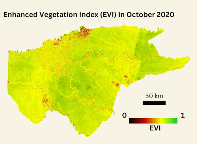
If you need high-quality processing of satellite or UAV imagery, you've come to the right place. I specialize in transforming raw imagery into accurate, actionable geospatial insights, including vegetation and water indices such as NDVI, NDWI, and NDBI, as well as land use and land cover classification using SVM or Random Forest, change detection, UAV photogrammetry, orthomosaics, and DSM/DTM extraction. I also work with Google Earth Engine for advanced data analysis and workflow automation.
My services range from simple index calculation for a single image to complete project workflows involving multiple images, full classification, change detection, orthomosaics, and all raw and processed outputs. This ensures that, whether your project focuses on environmental monitoring, agriculture, forestry, urban planning, marine applications, or engineering, you receive clean, accurate, and ready-to-use geospatial information.
To ensure you receive the most suitable package and results for your project, please contact me before placing an order so we can discuss your data and requirements.