Browse categories
Explore
Fiverr Pro
English
$
USD
PhD Researcher in Remote Sensing, GIS and Geospatial AI
Are you looking for expert satellite image processing and geospatial analysis for your project or research?
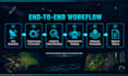
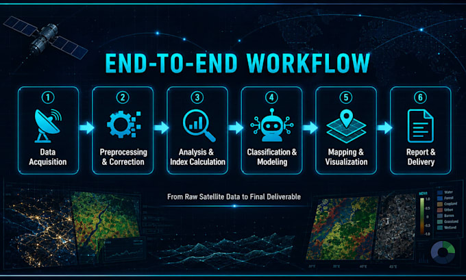
I will handle your remote sensing project completely from start to finish.
What I offer:
Satellite data acquisition & selection
Preprocessing & atmospheric correction
Image enhancement & band combination
Index calculation (NDVI, NDSI, EVI, NDWI...)
Classification & segmentation
Change detection & temporal analysis
Accuracy assessment & validation
Professional mapping & visualization
Results interpretation & reporting
Clean scripts & workflow documentation
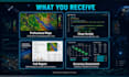
What you receive:
Publication-ready professional maps
Clean documented Python or GEE scripts
Full methodology & results report
Reproducible workflow
Why choose me?
PhD researcher in Remote Sensing & Geoinformatics with 5+ years of hands-on experience in satellite data processing, geospatial AI, and scientific research.
I work in English and French.
Message me before ordering to discuss your data and project needs!