Browse categories
Explore
Fiverr Pro
English
$
USD

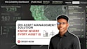
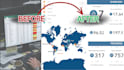
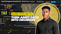
Gain Complete Visibility of Your Assets and Infrastructure
Many organizations struggle with scattered asset records, outdated maps, and limited visibility into infrastructure locations and conditions.
I help organizations create GIS-based asset management solutions that provide a clear view of assets, infrastructure networks, and operational information in one centralized system.
Whether you manage utilities, facilities, campuses, telecommunications infrastructure, pipelines, roads, or community assets, I can help transform your asset data into actionable insights.
Services Include:
Ideal For: Utility Companies, Schools & Universities, Hospitals, NGOs, Telecom Companies, Facility Managers, Government Agencies, Oil & Gas Companies, Property Manager and real estate developers and more...
I help organizations make better decisions using location intelligence and GIS
Languages
What types of assets can you map?
I can map virtually any location-based asset, including utilities, buildings, equipment, pipelines, telecom infrastructure, roads, drainage systems, streetlights, parks, campuses, environmental assets, and more. If your assets have a location, they can be organized and visualized in GIS.
What data do I need to provide?
You can provide your asset data in almost any format, including Excel, CSV, GPS coordinates, CAD drawings, shapefiles, GeoJSON, KML/KMZ, PDFs, or existing maps. If you're unsure about your data, send me a message and I'll help you determine what can be used.
Can you help if my asset data is incomplete or unorganized?
Yes. I can clean, standardize, and organize your data before creating the GIS asset map. If location information is missing, I'll advise you on the best approach based on the information available.
Will I receive editable GIS files?
Yes. Depending on your selected package, I can provide editable GIS data such as geodatabases, shapefiles, GeoJSON, or ArcGIS project files, along with presentation-ready maps in PDF or image formats.
Can you create an interactive GIS dashboard?
Yes. As an additional service, I can develop interactive dashboards that allow you to monitor assets, visualize key metrics, and explore your data in a more dynamic way.
I don't know exactly what GIS solution I need. Can you help?
Absolutely. Many clients know the problem they want to solve but aren't sure which GIS approach is best. Share your project or business challenge, and I'll recommend the most suitable solution before you place an order.
Can you sign a Non-Disclosure Agreement (NDA) or keep my project confidential?
Yes. I understand that many infrastructure, utility, and business projects involve sensitive information. I treat all client data with professionalism and confidentiality, and I'm happy to work under a Non-Disclosure Agreement (NDA) when required.


