Description:
- If you need professional GIS work combining web mapping and advanced raster analysis, you are in the right place.
- I provide high-quality services for environmental, agricultural, spatial planning, and research projects using ArcGIS, QGIS, Leaflet, and Mapbox.
What I offer:
-- Web Mapping (Leaflet / Mapbox / ArcGIS Online):
- Interactive web maps
- Custom markers, popups, and styling
- GeoJSON, SHP, KML, GPX integration
- Heatmaps and clustering
- Routing, geocoding, and search tools
- Mapbox style customization
- Embeddable maps for websites
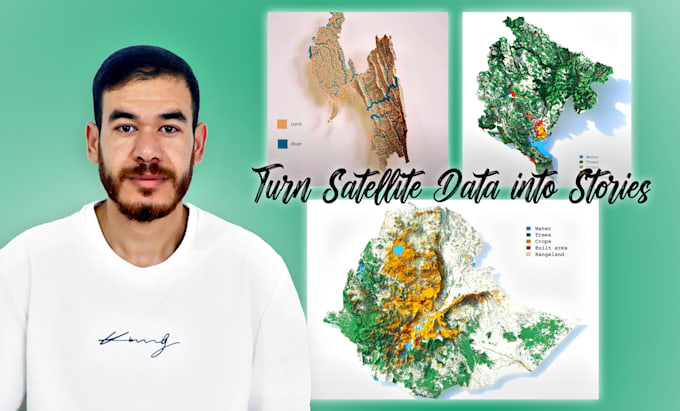
--Raster & Remote Sensing Analysis:
- NDVI, EVI, SAVI vegetation indices
- Land Use / Land Cover (LULC) classification
- Supervised and unsupervised classification
- Multi-temporal change detection
- Raster clipping, mosaicing, reprojection
- Zonal statistics and extraction
- Environmental and agricultural monitoring
--You will receive:
- Interactive map link or embedded code
- Clear and clean maps (PDF/PNG)
- Project files (GeoJSON, TIF, LYR, QGIS, ARCGIS PRO etc.)
--Why work with me?
- Strong GIS + Remote Sensing background
- Clean and optimized work
- Fast communication
- Solutions tailored to your project
Send me a message before ordering