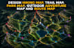
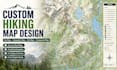
I will design hiking map trail map topographic map park map and campground map

E
elsa_adventure
E
elsa_adventure
Elsa Adventure

About this gig

Exploration becomes effortless when every path, elevation, and connection is designed with clarity and purpose.

I create professional mapping illustrations that combine accuracy with visual storytelling, helping hikers, travelers, planners, and outdoor enthusiasts navigate both natural and urban environments with confidence. Each map is crafted to be clean, readable, and visually engaging, turning complex geography into a simple and intuitive experience.


What I Offer:


  • Hiking Maps
  • Trail Maps
  • Topographic Maps
  • Transit Maps
  • Campground Map Illustrations
  • Route & Navigation Maps
  • Elevation & Terrain Maps
  • Park & Nature Maps
  • Custom Cartography Designs
  • Infographic Style Maps


Why Choose Me:


  • Clean, modern, and highly readable design style
  • Accurate geographic and spatial representation
  • Fast delivery with clear communication
  • Fully customized solutions for your project needs


Message me before placing your order so we can discuss your requirements and create a professional map that fits your outdoor, transit, or navigation project perfectly.

Delivery style preference

Please inform the freelancer of any preferences or concerns regarding the use of AI tools in the completion and/or delivery of your order.

Get to know Elsa Adventure

Elsa Adventure

Professional Cartographer And Map Designer

  • FromUnited Kingdom
  • Member sinceJun 2026
  • Languages

    English
Hello, I'm Elsa, a professional map designer specializing in hiking trail maps, park maps, campground maps, recreation maps, tourism maps, and custom cartographic design. I help outdoor businesses, campgrounds, parks, nature reserves, tourism organizations, hiking clubs, adventure companies, and property owners transform geographic information into clear, attractive, and easy-to-navigate maps. My map designs focus on clarity, accuracy, visual appeal, and usability while maintaining a professional cartographic standard.