I will perform real estate gis and spatial data analysis using python and gis

E
emdad1996
E
emdad1996
Emdadul Haque
5.0
5.0

About this gig

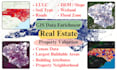
Are you looking for spatial data insights to optimize real estate decisions?

I provide real estate GIS and spatial data analysis to enhance property valuation, site selection, and pricing models using Python and GIS. If you have real estate property data or comps, I will enrich it with spatial insights for better decision-making.


What I Offer:

  • LULC: Percentage of different land cover types (trees, wetlands, built-up areas, etc.).
  • Elevation & Slope: DEM-based terrain statistics.
  • Soil & Wetland Analysis: Classification of soil types & percentage of property covered by wetlands.
  • Flood Zone Mapping: Percentage in risk categories.
  • Road & Accessibility: Distance to roads, nearest road types, and frontage.
  • Buildings: Count, area, setbacks, and nearest buildings.
  • Census Data: Social, economic, & crime statistics.
  • Building Characteristics: Orientation, height, aspect ratio, and zoning.
  • Property Neighborhood Analysis: Surrounding property characteristics (high-rise, mid-rise, residential, rural, etc.).
  • Buildable Areas: Largest possible buildable space.


Why Choose Me?

  • Expert in GIS & Python
  • Accurate, Data-Driven Insights
  • Fast Turnaround & Client Satisfaction


@ Let's Discuss Your Project

Get to know Emdadul Haque

Emdadul Haque

Spatial Data Scientist and Developer

4.8(31)
  • FromBangladesh
  • Member sinceApr 2022
  • Avg. response time1 hour
  • Last delivery10 months
  • Languages

    English
I am a Spatial Data Scientist and GIS programmer with over 7 years of professional experience. My work focuses on using GIS, remote sensing, and advanced data science techniques to solve complex spatial problems. I hold a M.S. from Central Michigan University, with advanced degrees in GIS, Remote Sensing, and Machine Learning. I have expertise in a wide range of geospatial fields, including GIS for real estate, precision-agriculture, remote sensing data analysis, forestry, environment and spatial data gathering and processing.
Reviews

1 reviews for this Gig
5.0

(1)
(0)
(0)
(0)
(0)
Rating Breakdown
  • Seller communication level
    5
  • Quality of delivery
    5
  • Value of delivery
    5
Sort By
Most relevant
  • D

    didarulislam628

    Repeat Client

    US

    United States

    5

    Thanks Emdad for quick delivery. Yes, the data sources listed in the doc is really helpful and thank you again for providing in depth insight for GIS data enrichment and property valuation algorithm. I particularly like the similarity score based approach for real-estate pricing model and will surely contact you to develop a prototype model.

    1 day

    Duration

    Helpful?
    Yes
    No