Browse categories
Explore
Fiverr Pro
English
$
USD
AI Powered Geospatial, Web GIS, and Infrastructure Engineering Solutions
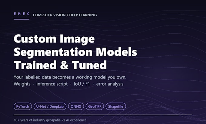
I build custom segmentation models on your labelled data - regular images or geospatial/satellite imagery. From a baseline trained model to a fully tuned, deployment-ready pipeline with georeferenced outputs, I deliver working models with real accuracy metrics, not just a picture.
Geospatial outputs (shapefile, GeoTIFF) available as a specialty for satellite, drone, or aerial imagery projects. Standard outputs (PNG masks) for regular image work.
Models are trained to an agreed accuracy on the data provided; validation metrics are reported where suitable reference data is available.
WHAT I NEED FROM YOU
- Your images plus labels/masks (COCO, YOLO, PNG masks or shapefile)
- Target classes and how you intend to use the model
- Any accuracy or inference-speed requirement
NOT INCLUDED: image annotation and labelling, imagery purchase, cloud/GPU compute costs, hosting, third-party API licences.
Message me with your dataset size and class list before ordering and I'll confirm the right package.
Programming language:
Python
Frameworks:
Scikit-learn
•
Keras
•
PyTorch
Do you provide the labelled training data, or do I?
You provide it. Annotation is not included: it is usually the largest single cost in a vision project and is quoted separately. Send images plus masks in COCO, YOLO, PNG-mask or shapefile format. If your labels are inconsistent, I will quote cleaning.
What accuracy can you guarantee?
Model quality depends on data quality, so work is scoped as trained to an agreed accuracy on the data provided. I report IoU and F1 against a held-out split, per-class metrics from Standard up, and validation metrics wherever reference data exists.
What exactly do I receive at the end?
Trained model weights, an inference script and metrics, all yours to keep and run. Standard adds tuning, augmentation and an error-analysis report. Premium adds a 2-3 architecture comparison, post-processing, geospatial exports and a deployment-ready pipeline.
Can you work with satellite, drone or aerial imagery?
Yes, that is the specialty. Geospatial projects get georeferenced outputs (shapefile/GeoTIFF) rather than plain PNG masks, so results drop straight into QGIS or ArcGIS. Multi-band and non-RGB imagery is fine: tell me the sensor and band layout.
Do you deploy the model for me?
Premium delivers a deployment-ready pipeline you can run yourself. Hosting, cloud and GPU costs, and integration into your own systems are not included, but I can quote deployment separately: API packaging, containerisation or edge devices.
