I will create professional maps and spatial analysis using qgis or arcgis

E
emma_b_george
E
emma_b_george
Emmanuel G.

About this gig

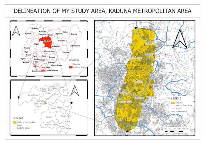
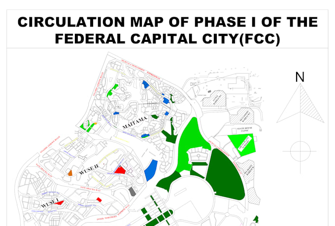
Do you need clean, accurate maps or expert spatial analysis for your project or report? I'm a GIS and urban planning specialist with hands-on experience in land use mapping, digitization, site suitability analysis, and layout design.

I use tools like QGIS, ArcGIS, and Google Earth to produce high-quality, data-driven maps tailored to your needs. Whether it's for academic work, urban development, research, or presentation, I've got you covered.

Services I offer:

  • Thematic maps (land use, zoning, infrastructure, etc.)
  • Georeferencing and digitization
  • Suitability/site selection analysis
  • Urban layout or development concept mapping
  • High-resolution maps for print or digital use

Lets bring your spatial ideas to life contact me before placing an order if you have questions!

Get to know Emmanuel G.

Emmanuel G.
  • FromNigeria
  • Member sinceJul 2025
  • Languages

    English, Hausa
I am a skilled Urban Planner, GIS expert, and Cartographer with over 6 years of experience delivering reliable, high-quality geospatial solutions. I provide a wide range of GIS services including georeferencing, geocoding, digitization, spatial and terrain analysis, satellite image processing, and geospatial database creation. With strong expertise in urban planning and visual communication, I develop sustainable, community-focused solutions and clear, compelling maps . With a keen eye for detail and a passion for excellence, I work towards combining form and function for impactful results.

My Portfolio