Browse categories
English
$
USD
Connect to your AI


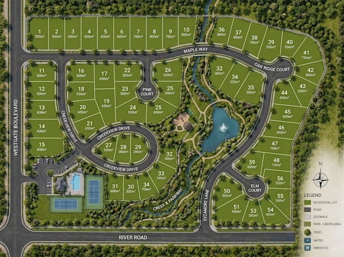
I create custom subdivision maps, land development plans, property layouts, and plot arrangement illustrations that help present land projects with clarity and organization.
WHAT I OFFER:
WHAT YOU WILL RECEIVE:
WHY CHOOSE ME?
I focus on clear presentation, organized plot arrangements, accurate representation of supplied information, and attention to detail. Every design is developed around your reference drawings, measurements, sketches, and project specifications.
Let's create a subdivision map that presents your land development project clearly. Send me your project details to get started.
Please inform the freelancer of any preferences or concerns regarding the use of AI tools in the completion and/or delivery of your order.
Isometric Map Designer
Languages
What information do you need to start a subdivision map?
I need your land dimensions, existing survey or site plan, number of plots, road requirements, preferred layout, and any reference images.
Can you design residential and commercial subdivision layouts?
Yes. I can create residential, commercial, mixed-use, and other property development layout illustrations.
Can you include roads, plot numbers, boundaries, and access routes?
Yes. I can illustrate plot divisions, lot numbering, road networks, access points, and other requested site features based on your supplied information.
Can you create both 2D and 3D land development maps?
Yes. I offer clean 2D subdivision layouts and visually detailed 3D isometric land development illustrations.
Which file formats will I receive?
Depending on your package, I can provide PDF, PNG, JPG, SVG, and editable source files such as AI, DWG, or other agreed formats.