Browse categories
Explore
Fiverr Pro
English
$
USD


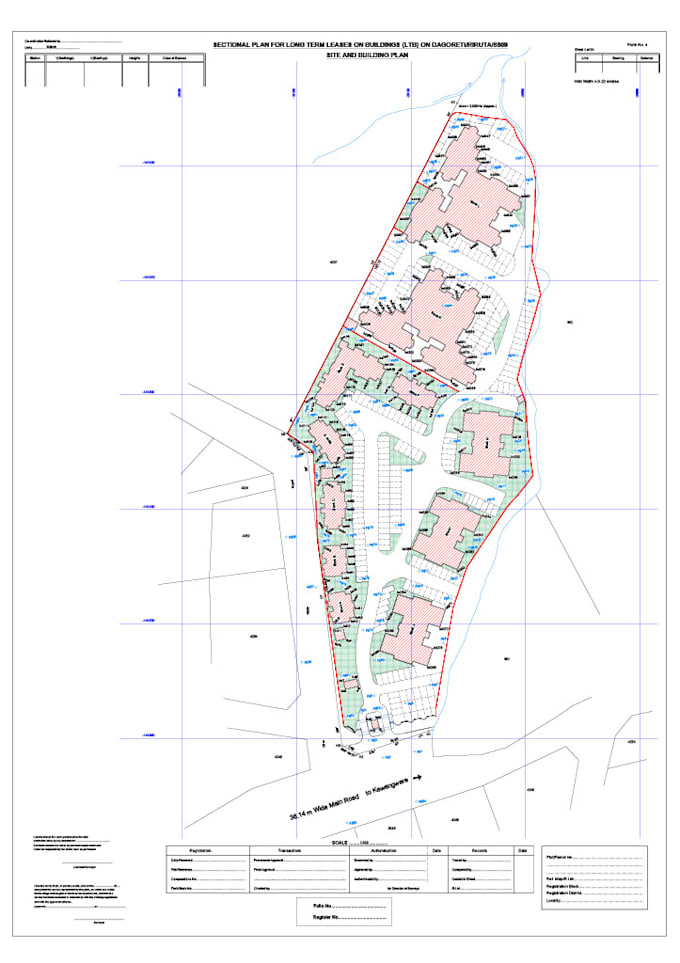
Are you looking for accurate, professional land survey services? Im a qualified geospatial land surveyor with expertise in AutoCAD Civil 3D, offering high-quality deliverables tailored to your project needs. I specialize in topographical surveys, site plans, subdivision layouts, and spatial planning for real estate, construction, and development projects.
Using advanced tools and software, I create detailed, precise drawings that meet local and international standards. Whether you need raw survey data transformed into clear plans, or a topographic map for your site, Ive got you covered.
Lets bring your land development vision to lifeefficiently, accurately, and professionally
Please inform the freelancer of any preferences or concerns regarding the use of AI tools in the completion and/or delivery of your order.
End to End Surveying,Planning,Mapping,Civil 3D Solutions
Languages