Browse categories
Explore
Fiverr Pro
English
$
USD
Are you facing project delays or need fast, professional site analysis for a permit application?
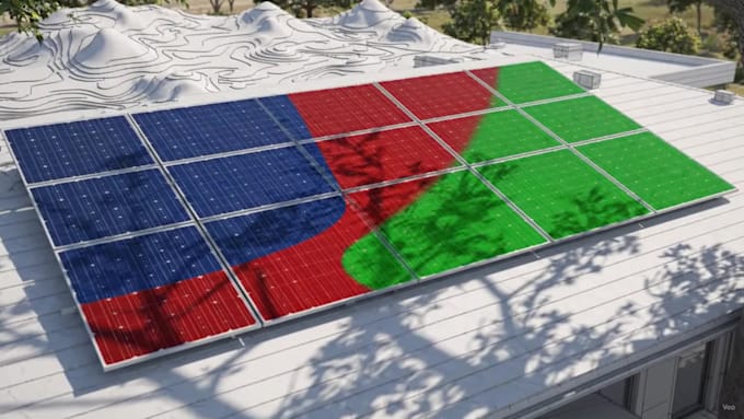
Accurate Site Shading and Shadow Studies are essential for building approvals. I provide high precision Solar Path Analysis and Topography Mapping that meet strict municipal requirements. Whether you are an architect, real estate developer, or homeowner, I deliver the high quality technical data required to prove compliance and optimize your buildings energy efficiency.
Why choose my services?
Stop letting environmental complexities stall your workflow. Message me today with your site address or project coordinates for a professional consultation. Lets get your project approved and moving forward!

Project type:
Residential
•
Commercial
•
Industrial
Solar system type:
Grid-connected
•
Off-grid
•
Hybrid
Software:
PVsyst
•
SketchUp
•
Homer Pro
Please inform the freelancer of any preferences or concerns regarding the use of AI tools in the completion and/or delivery of your order.
Which software do you use for these reports?
I use industry standard tools including Revit, SketchUp, and Rhino/Ladybug for precise solar path analysis. For topography and terrain modeling, I use ArcGIS or QGIS. This ensures your data is accurate, reliable, and compliant with professional engineering standards.
Are your shadow studies accepted by local planning councils?
Yes, My reports are designed to meet the rigorous technical standards of municipal planning boards and local authorities, ensuring you have the data needed for successful building applications and sustainable site development.
Can you provide the final deliverables in different formats?
Absolutely. I deliver high resolution PDF reports, clear visual diagrams for client presentations, and source files (DWG, DXF, or STL) upon request. Whether you need a simple visualization or detailed technical data for your engineers, I provide the files best suited for your project.