Browse categories
Explore
Fiverr Pro
English
$
USD


Are you looking for accurate environmental GIS analysis, not just basic map creation?
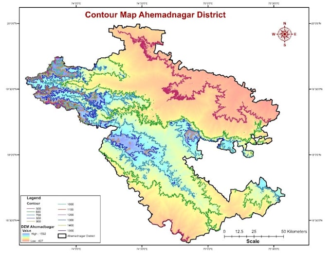
I provide specialized GIS-based environmental and hydrological analysis including flood risk mapping, watershed delineation, land use assessment, and environmental impact support studies. With an environmental engineering background, I focus on both spatial accuracy and scientific interpretation.
Services include:
Tools: ArcGIS / ArcGIS Pro, QGIS, Google Earth Engine (if required)
You will receive high-resolution maps (PDF/PNG), editable GIS files (SHP/GeoPackage), and clear methodology explanation if needed for academic or professional reports.
This gig is ideal for researchers, consultants, NGOs, planners, and students who need technically sound environmental GIS work.
Message me before ordering to discuss your project requirements.
Languages
What data do you need from me to start the work?
You can provide coordinates, shapefiles, satellite images, sketches, PDFs, or any available information. If you don’t have data, I can help source free and reliable GIS datasets for your project.