I will create topographic analysis, civil 3d, gis

E
engr_hamidul
E
engr_hamidul
Hamidul I

About this gig

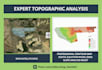
I specialize in processing satellite data, LiDAR, and survey points to deliver:

  • Detailed Contour Maps: Precision intervals (0.5m, 1m, 5m) for site planning.
  • Digital Elevation Models (DEM/DTM/DSM): High-resolution surface and terrain modeling.
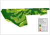
  • Slope & Aspect Analysis: Critical for drainage and construction feasibility.
  • Hydrological Analysis: Watershed delineation and flow direction mapping.
  • 3D Terrain Visualization: Realistic 3D renderings of your site.

Why Choose Me?

  • Software Expertise: I am proficient in ArcGIS Pro, QGIS, and AutoCAD Civil 3D.
  • Accuracy: I ensure all data is correctly georeferenced and projected.
  • Fast Delivery: Quality results with quick turnaround times.
  • Custom Formats: I provide files in PDF, DWG, SHP, TIFF, or KMZ.

What I Need From You Please provide the site location (coordinates or KML file) or your raw survey data (CSV/TXT/LAS).

Get to know Hamidul I

Hamidul I

Civil Engineer

  • FromBangladesh
  • Member sinceOct 2025
  • Avg. response time1 hour
  • Languages

    Bengali, English, French
With over 18 years of professional experience in Civil Engineering, I provide high-end technical solutions ranging from intricate structural analysis to working drawing for construction. My career has been built on a foundation of safety, accuracy, and aesthetic functionality. Whether you need a residential floor plan, a complex structural calculation for a multi-story building, or spatial data analysis via GIS, I bring nearly two decades of industry-standard expertise to every project. I am proficient in AutoCAD, Revit, ETABS, GIS and XL to bring precision in your project. Let's hear from you

My Portfolio