Browse categories
Explore
Fiverr Pro
English
$
USD
Sound floodplain decisions require a clear relationship between watershed inputs, channel behavior, crossing capacity and mapped water-surface elevations.
This service provides hydrologic and hydraulic analysis for land development, roadway, drainage and floodplain projects across the United States.
Technical support may cover:
Rainfall-runoff and peak-discharge calculations
Existing and proposed condition comparisons
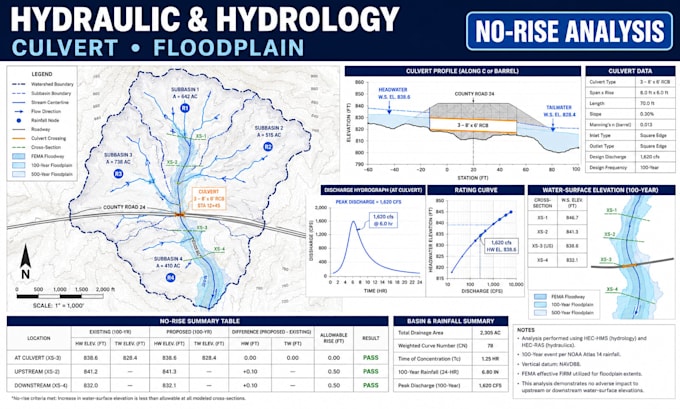
Culvert sizing, capacity and headwater evaluation
Open-channel and cross-section analysis
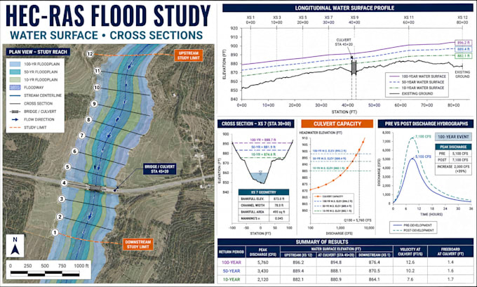
HEC-RAS 1D hydraulic modeling
Floodplain water-surface elevation review
No-rise evaluation and impact documentation
Flow tables, exhibits, maps and calculation summaries
Agency or reviewer comment responses
Results are organized into documentation for engineering coordination or regulatory submission. Model assumptions, boundary conditions, data gaps and limitations are stated transparently.
(Contact me) before ordering with the site location, survey, drainage area, models, rainfall criteria and agency comments. Required methods vary by FEMA region and local jurisdiction. Approval is controlled by the reviewing authority and is not guaranteed.
Project scale:
Building complex
Building type:
Residential
•
Commercial
•
Infrastructure
Material speciality:
Other
Please inform the freelancer of any preferences or concerns regarding the use of AI tools in the completion and/or delivery of your order.
What information is needed to begin the analysis?
Provide the project location, survey or terrain data, drainage-area map, rainfall criteria, existing studies or models, culvert details, proposed changes and agency comments.
Which software and calculation methods are used?
HEC-RAS may be used for hydraulic modeling when appropriate. Hydrology methods and supporting tools are selected from the available data and the reviewing jurisdiction’s criteria.
Can an existing culvert and a proposed replacement be compared?
Yes. Capacity, headwater, tailwater, velocity and water-surface impacts can be compared when sufficient geometry, flow data and downstream conditions are available.
Is this service available throughout the United States?
Yes. Projects are accepted nationwide. FEMA guidance and state, county, municipal or drainage-district requirements are reviewed for the specific location.
Is a signed no-rise certificate or professional seal included?
Not automatically. If the reviewing authority requires certification or a seal, contact me first so coordination with an appropriate state-registered professional can be scoped separately.