Browse categories
Explore
Fiverr Pro
English
$
USD


Are you looking for professional GIS mapping, spatial analysis, or custom map production? You're in the right place!
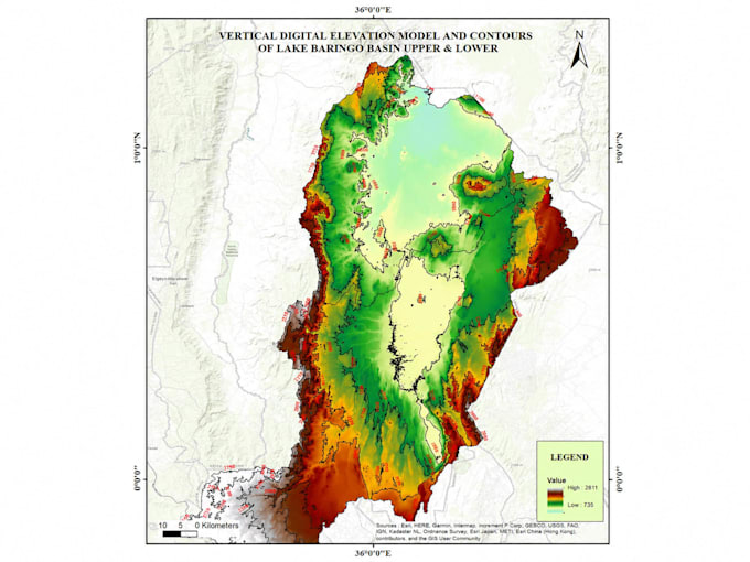
I am a GIS & Remote Sensing Specialist with 5+ years of experience delivering high-quality geospatial solutions for environmental, infrastructure, utility, conservation, and development projects across Kenya and beyond.
What I offer:
Tools I use: QGIS, ArcGIS, ArcPro, Google Earth Engine, ILWIS, Python (geospatial automation)
GIS Expert, Remote Sensing Specialist, Data Analyst, AI ML Specialist, Drone Pil
Languages
What information do I need to provide to get started?
Please share your area of interest (coordinates, shapefile, or description), the type of map/analysis needed, preferred software (QGIS/ArcGIS), and any data you already have. I'll guide you from there!
What file formats will I receive for the final deliverables?
You'll receive your maps as high-resolution PNG/PDF for print or presentation, plus shapefiles (.shp), GeoJSON, or geodatabase formats for GIS data, depending on your needs.
Can you work with my existing data or satellite imagery?
Yes! I can work with your shapefiles, raster data, GPS points, CSV coordinates, or satellite imagery. I also source data from Google Earth Engine, OpenStreetMap, and other platforms if needed.
How long does a typical GIS mapping project take?
Simple maps take 1–2 days. Spatial analysis or multi-layer projects take 3–5 days. Complex geodatabase or remote sensing work may take longer. Timelines are always discussed upfront.
Do you offer revisions if I'm not satisfied with the output?
Absolutely! I offer revisions to ensure the final map meets your expectations. Clear communication and client satisfaction are my top priorities.