Browse categories
Explore
Fiverr Pro
English
$
USD
Ghana
GIS, Remote Sensing, and Data Analysis Expert
Are you looking for professional GIS mapping, spatial analysis, or remote sensing services? You are in the right place!
I am a GIS and Data Analyst with experience in spatial analysis, satellite imagery processing, and data visualization. I help clients transform complex geospatial data into clear, actionable insights.
My Services Include:
-GIS mapping (QGIS & ArcGIS)
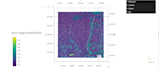
-Remote sensing analysis (NDVI, land use/land cover)
-Spatial data analysis and visualization
-Satellite imagery processing
-Data analysis using Python, Excel, and R
Why Choose Me?
-Accurate and high-quality results
-Fast and reliable delivery
-Clear communication
-Support for research, NGOs, and business projects
️Lets work together to bring your data to life!