Browse categories
Explore
Fiverr Pro
English
$
USD

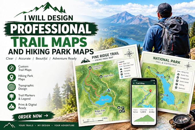
Are you looking for a clean, professional, and easy-to-read map for your park, hiking trail, or outdoor resort? You are in the right place!
I will turn your raw GPS data, hand-drawn sketches, or Google Earth KML files into beautiful, high-quality trail maps that your visitors will love. Perfect for national parks, campsites, eco-resorts, travel guides, and property owners.
---
WHAT YOU WILL GET:
High-resolution, print-ready files (PDF, PNG, JPG)
Clear trail lines, custom markers, and legends
Beautiful topographic terrain shading
Custom branding matching your park's colors and logo
---
WHY WORK WITH ME?
Professional GIS expertise (ArcGIS & QGIS) combined with Adobe Illustrator design.
100% accurate trail placements.
Quick response times and friendly communication.
Please message me before placing an order so we can discuss your specific project layout!
Please inform the freelancer of any preferences or concerns regarding the use of AI tools in the completion and/or delivery of your order.
Expert GIS Cartographer and Illustrated Map Designer
Languages
What do I need to provide to start the order?
You can provide any data you have, such as GPS tracks (GPX/KML files), a Google Maps screenshot, a hand-drawn sketch, or written descriptions of your trails and landmarks.
Can you design a map without GPS coordinates?
Yes! If you do not have GPS coordinates, I can use your hand-drawn sketch or reference points on Google Earth to draft a highly accurate vector layout.
Will the map be ready for printing?
Absolutely. All final map designs are delivered in high-resolution (300 DPI) CMYK formats, perfect for brochures, signboards, or digital websites.
Can you match my existing brand colors and font style?
Yes, please provide your brand guidelines, logo files, and specific font preferences when submitting your order details.
