Browse categories
Explore
Fiverr Pro
English
$
USD

Level 2


Note: Before purchasing, please contact me in inbox to discuss your project details, delivery time, and pricing. The price shown in the gig is only for ranking purposes. Please let me know what data and files you already have and what is missing. You can share details such as parcel boundaries, rough sketches, concept plans, survey files, coordinates, or georeferenced data. If some data is not available, I can also guide you on where and how it can be obtained. Feel free to discuss everything in inbox before placing the order so the project scope, timeline, and cost can be decided accurately.
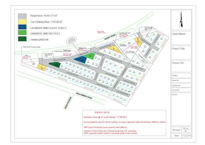
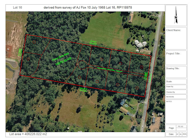
I provide professional GIS and AutoCAD services for land subdivision, plot area calculation, site plan design, and survey plan redrawing. Using ArcGIS, spatial analysis, and georeferencing techniques, I create accurate subdivision layouts, contour maps, and coordinate-based plans for residential and commercial developments.
Services also include terrain analysis and land optimization to ensure efficient and sustainable development. Final deliverables include precise GIS maps and AutoCAD drawings tailored to your project needs.
#AutoCAD #Subdivision #Architectural #GISServices #SitePlanDesign #
Fiverr does not screen freelancers in this category. Please verify qualifications and discuss requirements with the freelancer before ordering, including any preferences regarding the use of AI tools.
Architectural Land Surveying Landscape Designer
Level 2
Languages