Browse categories
Explore
Fiverr Pro
English
$
USD


Hello,
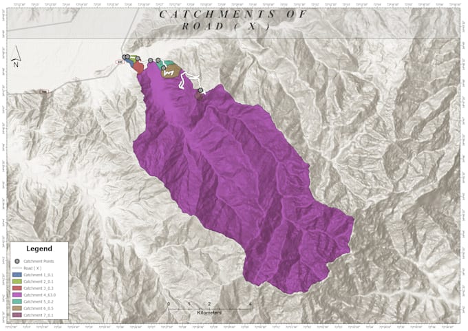
Hydrology keep an important role in everyday our daily life and find out of hydrological parameters has always been a challenge for engineers,
But with the advent ion of GIS and spatial data analysis, these measurements have become more technical and easier,
I shall provide services while using GIS tool and techniques for the following.
Road rehabilitation/restoration, effected due to flood.
Strahler stream network
Manipulation and processing Related to digital elevation model (DEM)
Catchment, watershed delineation, drainage, Stream order.
and many more related services.
FEEL FREE TO CONTACT.
Languages