Browse categories
Explore
Fiverr Pro
English
$
USD


Stop making static maps. Start building geospatial workflows.
I use Google Earth Engine, GIS, and satellite data to create outputs for mapping, monitoring, and decision support. My focus is not just writing code, but building workflows that are organized, reliable, and useful for projects
Why work with me?
Earth Engine Expertise: I build, fix, and improve workflows for analysis, mapping, and exports.
Structured Approach: My work is based on logic, careful processing, and dependable outputs.
Scalable Solutions: I create workflows for large datasets, multi-date analysis, and repeatable processing.
What I Build
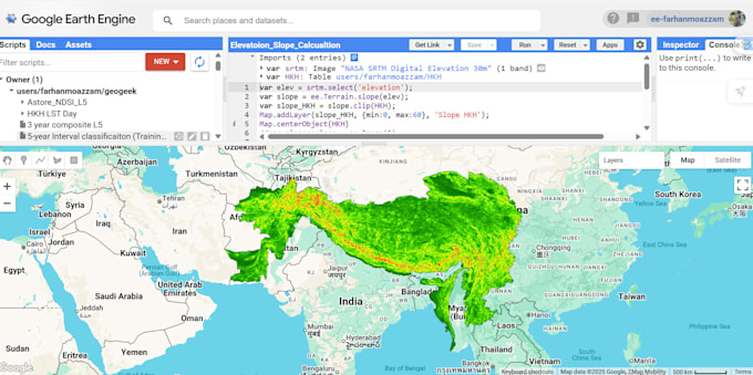
Automated Workflows: Process Sentinel, Landsat, MODIS, CHIRPS, and ERA5 datasets.
Spatial Analysis: Land cover, change detection, vegetation indices, and climate mapping.
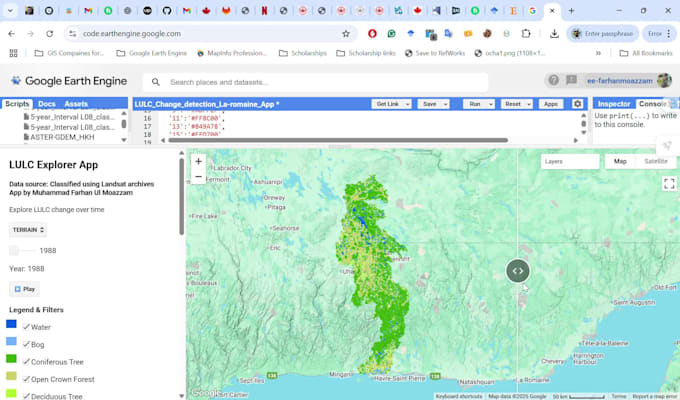
Interactive Outputs: Earth Engine Apps, maps, charts, and layers.
Python Integration: Geemap, Jupyter, and GIS workflows.
Specializations
Land cover mapping.
Time-series and change detection.
Water, vegetation, and climate analysis.
Hazard and environmental monitoring.
My Commitment: You receive clean, structured, end-to-end project-focused work, not just code.
Contact me before ordering!
Turning Earth observation data into powerful insights
Languages