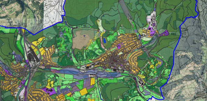
I will professional gis maps using qgis

F
felix_ramadl
F
felix_ramadl
Felix Adler

About this gig

Professional GIS Mapping & Geospatial Data Processing with QGIS

Are you looking for a professional GIS map for your project?

I am an Environmental Scientist (B.Sc.) and freelance Environmental Planner with practical experience in QGIS, geospatial data processing and cartography.

My services include:

  • Professional thematic GIS maps
  • Geospatial data editing and visualization
  • Digitization of polygons, lines and geographic features
  • Land-use and habitat mapping
  • Attribute data processing and classification
  • Spatial analysis and GIS data management
  • Professional map layouts with legends, labels and scale bars

Choose the right package:

Basic: One professional map using your existing GIS data.

Standard: One detailed map including data editing and limited digitization.

Premium: One advanced map including more extensive data processing, digitization and spatial analysis.

Each package includes one GIS map. The complexity and amount of work depend on your selected package.

Please contact me before ordering to discuss your project requirements.

Get to know Felix Adler

Felix Adler

Environmental Planner GIS Specialist

  • FromGermany
  • Member sinceNov 2026
  • Languages

    German, English, Spanish
I am an Environmental Scientist (B.Sc.) and freelance Environmental Planner specializing in GIS, QGIS, mapping and geospatial data processing. I support environmental projects through GIS analysis, map digitization, thematic mapping and spatial data visualization. My expertise includes ecology, nature conservation, habitat mapping, land-use mapping and environmental data analysis. I am also interested in ecological monitoring and field surveys. I provide accurate, reliable and well-structured results, with a strong focus on quality and clear communication.