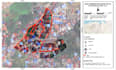
I will create land suitability soil fertility, and ndvi maps using gis app

F
firhan_ak
F
firhan_ak
Firhan AK

About this gig

Welcome to my Professional GIS & Spatial Analysis Gig!

Are you looking for an expert to handle your geospatial data, satellite imagery, or environmental mapping? With a strong academic background in Agricultural Sciences and extensive hands-on experience in GIS, I am ready to transform your complex spatial data into accurate, visually stunning, and actionable maps.

What I provide in this Gig:

  • Agriculture & Environment: Soil fertility mapping, land suitability analysis, and crop health monitoring (NDVI/Vegetation Indices).
  • Disaster Management: Natural disaster hazard, vulnerability, and flood evacuation routing maps.
  • Urban & Regional Mapping: Land use/land cover classification and precise administrative boundaries.
  • Advanced Analysis: Spatial prediction and satellite imagery processing.

Software & Tools I Master:

  • ArcGIS Pro & QGIS
  • Google Earth Engine (GEE)
  • Various Satellite Imagery Platforms

Why choose my service?

  • High-quality, print-ready, and professional map layouts.
  • Academic-level accuracy and attention to detail.
  • Fast delivery and responsive communication.

Please note: Every spatial project is unique. Kindly send me a message before placing an order so we can discuss your specif

Get to know Firhan AK

Firhan AK

Expert GIS Analyst, Satellite Imagery, Agriculture and Environmental Mapping

  • FromIndonesia
  • Member sinceSep 2026
  • Languages

    Indonesian, English
I am a profesional GIS Analyst. I specialize in transforming complex geospatial data and satellite imagery into actionable insights, visually stunning maps, and comprehensive spatial models. I bring advanced proficiency in ArcGIS Pro, QGIS, and Google Earth Engine (GEE). I can process the Agricultural and Environmental Modeling: Soil fertility mapping, land suitability analysis, crop health monitoring (NDVI), and agroforestry mapping and Disaster Risk Management: Development of natural disaster hazard and vulnerability maps, and detailed flood evacuation routing.