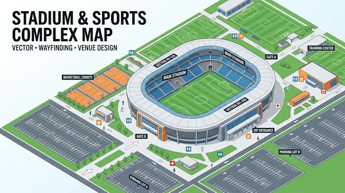
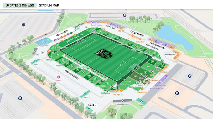
I will design a vector stadium map and sports complex wayfinding illustration

G
gabriel_ryan6
G
gabriel_ryan6
Gabriel Ryan

About this gig

HELLO THERE!

Turn your sports venue layout into a clear, professional navigation map built for spectators and visitors.

I design custom vector stadium maps and sports complex wayfinding illustrations for stadiums, arenas, training centers, athletic facilities, sports parks, and event venues. I transform site plans, seating layouts, aerial views, or sketches into easy-to-follow visual maps.


What I Can Map Out For You:

  • Stadiums, arenas, grandstands, seating sections, VIP areas, entrances, and concourses.
  • Sports complexes, training facilities, courts, fields, gyms, pools, and recreational areas.
  • Parking, pedestrian routes, gates, restrooms, concessions, ticket offices, and accessibility paths.
  • Directional routes, landmarks, facilities, information points, and visitor zones.


Why Choose This Service?

  • Scalable Vector Design: Ideal for signage, event programs, brochures, websites, and large displays.
  • Clean layouts with readable labels, icons, pathways, gates, and navigation markers.
  • Professional Delivery: PNG, JPG, print-ready PDF, and AI/source files.


Send me your venue plan and message me before ordering. Lets create a clear, professional wayfinding map for your sports venue.

Delivery style preference

Please inform the freelancer of any preferences or concerns regarding the use of AI tools in the completion and/or delivery of your order.

Get to know Gabriel Ryan

Gabriel Ryan

MAP DESIGN

  • FromUnited Kingdom
  • Member sinceSep 2026
  • Languages

    English, German, French
Hello There!!! I’m Gabriel Ryan, a map designer focused on creating clear, accurate, and professional maps for businesses, properties, tourism, land development, facilities, and digital platforms. I work with GIS data, vector graphics, location information, and client references to create well-organized maps with clean layouts, labels, icons, routes, boundaries, and points of interest. My goal is simple: turn geographic information into maps that are easy to understand, visually professional, and practical for their intended use.