Browse categories
Explore
Fiverr Pro
English
$
USD


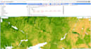
Are you looking for advanced geospatial analysis and visualization using Google Earth Engine (GEE)? I specialize in leveraging GEE's cloud-based platform to analyze, map, and interpret remote sensing data, environmental changes, and spatial patterns.
Whether you need satellite imagery analysis, land cover mapping, or time-series insights, I provide tailored solutions for your geospatial data needs. Let me help you harness the full power of GEE!
What I Offer:
Why Choose Me?
Languages
What kind of data can you analyze with Google Earth Engine?
I can analyze various datasets like Landsat, Sentinel, MODIS, and others to generate insights for vegetation, urban growth, water bodies, and more.
Can you provide custom scripts for Google Earth Engine?
Yes, with the Premium Package, I provide custom GEE scripts for automating workflows tailored to your requirements.
What formats will I receive the output in?
Deliverables include GeoTIFF, PNG, CSV, Shapefile, or other formats based on your needs.
Do you provide reports or documentation?
Yes, I include detailed reports and documentation for every project, explaining the methods and results.
Can you handle large-scale projects?
Absolutely! I specialize in processing large datasets and integrating multiple analyses to deliver comprehensive results.


