Browse categories
English
$
USD
Connect to your AI


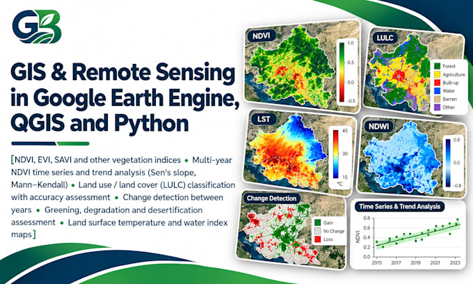
Need satellite-based vegetation or land cover analysis for your research or project? I analyse Landsat and Sentinel-2 imagery in Google Earth Engine and deliver maps, statistics and reproducible scripts.
What I do:
What you get:
I have published long-term NDVI analysis of a desert region, so I know what reviewers ask for.
Please message me before ordering with your study area, years and the analysis you need.
Data Analyst and GIS Specialist using R, Python, SPSS, ArcGIS and QGIS
Languages
Which satellites do you use?
Landsat for long time series and Sentinel-2 for higher resolution (10 m), depending on your years and area.
Do I need to provide the imagery?
No. Only your study area boundary or name and the years.
Can you do classification for my own classes?
Yes, with your class list and, ideally, some ground points.
Will I get the code?
Yes. Standard and Premium include the GEE script.
Can you work on any country?
Yes. Satellite data covers the whole world.