Browse categories
Explore
Fiverr Pro
English
$
USD

Level 1


Gig Summary
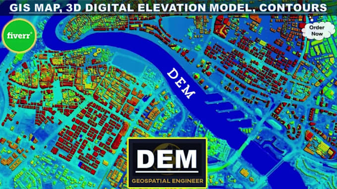
I am a Geospatial Engineer (MSc) with 20+ years' experience creating Digital Elevation Models, Contour Maps, GIS solutions, LiDAR, and surveying. I help engineers, consultants, researchers, and land developers turn raw elevation data into precise, decision-ready surface models.
This gig includes:
Core Deliverables
Additional Services
I deliver in the file format and resolution that fits your software. Just tell me your target program and I'll size files accordingly.
Tools I use: ArcGIS Pro, QGIS, Google Earth, Global Mapper, Pix4D, Metashape, AutoCAD Civil 3D
Trusted by repeat clients worldwide.
Message me your data source and project area (address, coordinates, or Google Maps pin), and I'll confirm scope, deliverables, and turnaround before you order.
GIS Mapping, Drone Surveying, CAD Site Plans, 3D Modeling and Animations
Level 1
Languages
What is a Digital Elevation Model (DEM)?
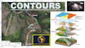
A Digital Elevation Model (DEM) is a 3D computer graphics representation of elevation data to represent terrain. DEM is a raster GIS layer with raster grids of the Earth’s surface referenced to the vertical datum (Zero Elevation).
What are Contour Lines and Topographic Maps?
Put simply, contour lines mark points of equal elevation on a map. Topography is the study of geographical features on a landscape. A map with contour lines on it is called a topographic map. Essentially, topographic maps represent the three-dimensional landscape of Earth within 2D space of a map.
What data do you require to create a DEM and contour map?
To create a DEM and contour map, I typically require elevation data from sources such as Land Surveying topo or Ground Surveys (GNSS, DGPS, Total Station, Laser Scanner, LiDAR), Photogrammetric stereo imagery (satellite images, aerial photographs), SAR, Radar datasets or topographic sheets.
Can you customize the contour intervals and map specifications according to my requirements?
Absolutely! I understand that different projects may have unique requirements. Whether you need specific contour intervals, map extents, coordinate systems, or other specifications, I can tailor the deliverables to meet your exact needs.
What types of projects can benefit from your services?
My services are ideal for a wide range of projects, including land development, engineering design, watershed modeling, site planning, climate analysis, and more. Whether you're an engineering firm or an environmental consultant, I can help you with your GIS contour mapping and DEM needs.
What are extended applications of Digital Elevation Models?
- Geographical Information Systems / GIS Mapping - Land Surveying & Topo Contours - 3D Visualization - Civil Engineering - Hydrology / Hydrological Modeling - Flood Inundation Models and Mapping - Highways / Environmental / Water Resource Engineering - Telecom and Utility
What software do you use to develop DEMs and contour maps?
I specialize in using ArcGIS Pro, a professional GIS software, to develop high-quality DEMs and contour maps. ArcGIS Pro offers advanced capabilities for terrain analysis and visualization, ensuring accurate and detailed results.
What is the typical turnaround time for delivering the final product?
The turnaround time can vary depending on the complexity and scope of the project. Upon discussing your requirements, I'll provide you with an estimated delivery timeline. Rest assured, I strive to deliver high-quality results in a timely manner to meet your project deadlines.
Do you offer revisions if I am not satisfied with the initial deliverables?
Yes, customer satisfaction is paramount to me. I offer revisions to ensure that the final deliverables meet your expectations and project requirements.
| (15) | ||
| (1) | ||
| (0) | ||
| (0) | ||
| (0) |
bleblanc03

United States
Great to work with. Delivered nice assets for my project. I would not hesitate to reach out again if/when I need more work at this level.
$400-$600
Price
3 weeks
Duration
jebjeb2000
United States
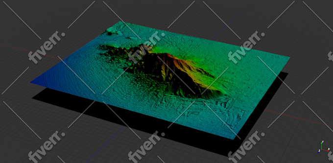
I needed a model of a mountain for architectural rendering. Geospatial provided a highly detailed file that was actually far too large for my program to handle. Geospatial followed up with several options of smaller size, and I was able to use the edits. They were communicative in adjusting the parameters to fit what I needed. Thank you!
$200-$400
Price
2 weeks
Duration

Seller's Response
ricmed372
United States
Thank you. I appreciate the work
$100-$200
Price
5 days
Duration

jasonwarner845

Costa Rica
This is my third order with Geospatial. Always high quality, timely, and visually appealing.
$50
Price
1 day
Duration
jasonwarner845
Costa Rica
This is my second project with Geospatial Engr. I found them after an underwhelming experience with another provider. Very pleased with the technical capabilities and professional way they presented the data. When the need arises, I would be happy to work with Geospatial again.
$100-$200
Price
8 days
Duration
| (15) | ||
| (1) | ||
| (0) | ||
| (0) | ||
| (0) |
bleblanc03
United States
Great to work with. Delivered nice assets for my project. I would not hesitate to reach out again if/when I need more work at this level.
$400-$600
Price
3 weeks
Duration
jebjeb2000
United States
I needed a model of a mountain for architectural rendering. Geospatial provided a highly detailed file that was actually far too large for my program to handle. Geospatial followed up with several options of smaller size, and I was able to use the edits. They were communicative in adjusting the parameters to fit what I needed. Thank you!
$200-$400
Price
2 weeks
Duration
Seller's Response
ricmed372
United States
Thank you. I appreciate the work
$100-$200
Price
5 days
Duration
jasonwarner845
Costa Rica
This is my third order with Geospatial. Always high quality, timely, and visually appealing.
$50
Price
1 day
Duration
jasonwarner845
Costa Rica
This is my second project with Geospatial Engr. I found them after an underwhelming experience with another provider. Very pleased with the technical capabilities and professional way they presented the data. When the need arises, I would be happy to work with Geospatial again.
$100-$200
Price
8 days
Duration