Browse categories
Explore
Fiverr Pro
English
$
USD

Level 2


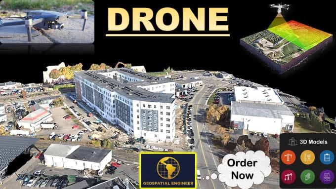
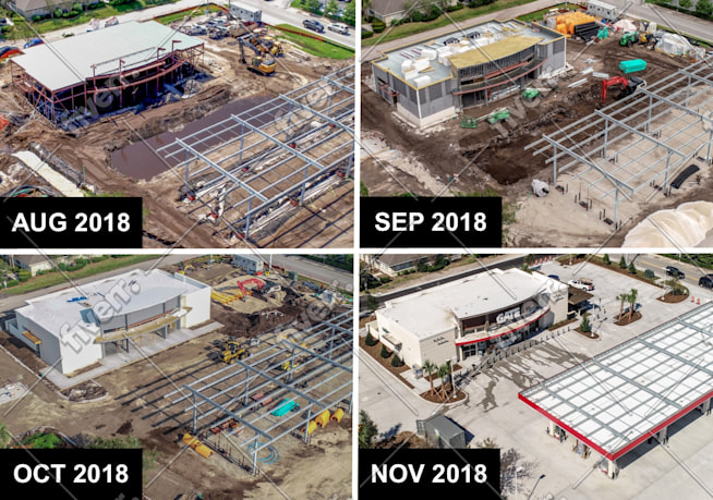
I am an Expert in Aerial Surveying, Photogrammetry, Drone Data Processing, and Mapping, offering professional services tailored to your project's needs. Using advanced drone technology, I deliver high-quality orthomosaic maps, detailed 3D models, and precise point clouds for construction, civil engineering, real estate, land development, agriculture, and more.
Whether you need accurate terrain data, volumetric analysis, or visual site inspection, I provide fast turnaround and reliable results with georeferenced and ready-to-use outputs.
Services include:
Software I use:
As a Drone Specialist, I expertly handle photogrammetric data from DJI drones (Matrice, Mavic, Mini, Inspire, Phantom, Air) and fixed-wing or hybrid UAVs like the senseFly eBee and Wingtra.
Let us bring your project to life with cutting-edge drone data. Contact me to get started!
CONTACT BEFORE ORDER
+ Excellent rating by FIVERR Buyers.
Please inform the freelancer of any preferences or concerns regarding the use of AI tools in the completion and/or delivery of your order.
Pro Experts in GIS, Mapping, 3D Models, Drones, and Civil Engineering
Level 2
Languages
| (4) | ||
| (0) | ||
| (0) | ||
| (0) | ||
| (0) |
laynesup
Repeat Client

United States
Seller was great to work with, much appreciated!

Seller's Response
laynesup
Repeat Client
United States
Seller was great to work with! Looking forward to working with him in the future!
Seller's Response
raitisupmalis

Latvia
Easy to communicate, hope for further cooperation
homerotorres

Brazil
Geospatial_engr is impressive knowledgeable in his area, he really loves his job and is very creative when talking about solution design alternatives. He is very communicative and has a perfectly English written and spoken. He demonstrated a deep expertise and he will for sure contribute a lot in a lead I am working hard to convert in a deal.
Seller's Response
| (4) | ||
| (0) | ||
| (0) | ||
| (0) | ||
| (0) |
laynesup
Repeat Client
United States
Seller was great to work with, much appreciated!
Seller's Response
laynesup
Repeat Client
United States
Seller was great to work with! Looking forward to working with him in the future!
Seller's Response
raitisupmalis
Latvia
Easy to communicate, hope for further cooperation
homerotorres
Brazil
Geospatial_engr is impressive knowledgeable in his area, he really loves his job and is very creative when talking about solution design alternatives. He is very communicative and has a perfectly English written and spoken. He demonstrated a deep expertise and he will for sure contribute a lot in a lead I am working hard to convert in a deal.
Seller's Response