Browse categories
Explore
Fiverr Pro
English
$
USD


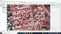

I will do Digitization of Planned areas, unplanned areas with attributes. I will create special model or Attributes, which fulfil all of your categories.
Planned areas
Unplanned areas
developed Areas
Undeveloped Areas
Attributes
I will create other maps:
1.Thematic Map and Layout Preparation
2.Data conversation (to Raster, KML, Shapefile, Geodatabase and Raster)
3.Data Projection and Transformation
4.Digital Elevation Model
5.Georeferencing
6.Land Use Land Cover
7.Watershed delineation
8.Stram or drainage density
9.Study area map
10.River stream order map
11.NDVI and other indices
12.Land surface temperature
13.Hotspot crime analysis
Languages


