Browse categories
Explore
Fiverr Pro
English
$
USD


I will provide precise georeferencing and georectification services for your spatial data
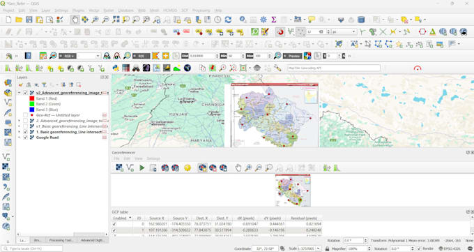
I transform your non-spatial images into accurate, GIS-ready data layers. Using professional QGIS software, I ensure your maps are perfectly aligned for research, urban planning, environmental analysis, and visualization projects.
I WILL GEOREFERENCE YOUR:
YOU WILL RECEIVE:
PACKAGES:
Message me to discuss your project details before ordering!
GIS and Remote Sensing Specialist
Languages
What information do you need from me to start the georeferencing process?
To ensure the highest accuracy, I typically need: 1) Your scanned map or image file (PDF, JPG, TIFF, etc.). The location the map represents (e.g., "Downtown Boston" or coordinates). 2) The desired Coordinate System (e.g., WGS84, UTM Zone 15N)
How do you measure the precision and accuracy of your work?
I use the Root Mean Square Error (RMSE), which is the standard metric for measuring georeferencing accuracy. A lower RMSE means higher precision.
My map is old/historical and doesn't have clear landmarks. Can you still georeference it?
Absolutely. Georeferencing historical maps is a common and specialized task. I use known geographic features like coastlines, river intersections, historic street corners, or mountain peaks as control points. For such projects, I recommend the STANDARD or PREMIUM package for the extra time and care.
What file formats will I receive after the work is complete?
You will receive the georeferenced image file along with the necessary world file. Common delivery formats include GeoTIFF (most widely compatible with GIS software) or a JPG/PNG with a .jgw/.pgw world file. I can also provide KMZ files for Google Earth. Just let me know your preferred format.
What if the georeferenced map isn't aligned correctly?
Your satisfaction is guaranteed. All packages include free revisions to correct the alignment based on your feedback. Please provide any reference data or specific points you feel are misaligned, and I will promptly correct it.