Browse categories
Explore
Fiverr Pro
English
$
USD

_compressed_tlbiu9.jpg)
_compressed (1)_lciozf.jpg)
Environmental hazards are complex. Your maps shouldn't be.
If you need to assess flood exposure, landslide susceptibility, terrain conditions, or environmental risk, I turn raw geospatial data into clear, decision-ready maps.
I provide professional GIS spatial analysis using QGIS, remote sensing, and rigorous GIS raster analysis methods including DEM, slope, drainage, land cover, and multi-criteria modeling.
What I can deliver:
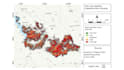
Flood susceptibility and risk maps
Landslide susceptibility maps
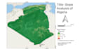
DEM, slope, terrain & raster analysis
Multi-criteria hazard modeling
Clean, professional hazard mapping GIS
QGIS project/source files when included
You are not hiring a button-pusher. I review your data, recommend the right analytical approach, and translate complex spatial results into maps that researchers, engineers, and decision-makers can understand with confidence.
Send me your study area and available data, and Ill help define the right workflow before we begi
Geospatial Analyst GIS and Remote Sensing Expert
Languages
Q: What data do you need to start?
Send any available DEM, shapefiles, GeoJSON/KML, rainfall, land cover, drainage, soil, or satellite data. If you do not have all the required datasets, contact me first and I can advise what is needed.
Q: Can you create both flood and landslide susceptibility maps?
Yes. I can analyze flood, landslide, terrain, and multi-hazard scenarios depending on your study area, available data, and project objective.
Q: Do you provide the QGIS source files?
Yes. QGIS project and organized GIS layers are included in selected packages or can be added as an extra.
Q: Can you follow a specific research or engineering methodology?
Yes. Share the required method, reference paper, guideline, or criteria. If you do not have one, I can recommend an appropriate workflow based on your project.


