Browse categories
Explore
Fiverr Pro
English
$
USD


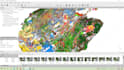
Transform your images into accurate geospatial products with professional photogrammetry services. I process drone, aerial, terrestrial, and close-range imagery to create high-quality mapping and 3D reconstruction deliverables for surveying, construction, mining, agriculture, architecture, archaeology, environmental monitoring, and GIS applications.
Please inform the freelancer of any preferences or concerns regarding the use of AI tools in the completion and/or delivery of your order.
Precision GIS,Remote Sensing and Photogrammetry Service
Languages


