Browse categories
Explore
Fiverr Pro
English
$
USD
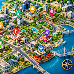
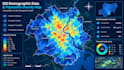
I create detailed map illustrations that transform demographic datasets into meaningful, easy to understand visual information for research, planning, business, and community development.
WHAT I OFFER
GIS demographic data mapping
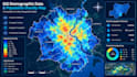
Population density maps and illustrations
Community statistics and census maps
Thematic and choropleth maps
Geographic data visualization
Administrative boundary and regional maps
Custom map layouts with legends, labels, and scale bars
High resolution map exports for reports and presentations
WHY CHOOSE ME
I focus on accurate data presentation, clear geographic visualization, organized map layouts, and attractive color schemes. I work with your available datasets and mapping requirements to produce maps that communicate information effectively. I can also help prepare suitable geographic data for visualization, depending on your project needs.
Send me your location, demographic dataset, preferred map style, and project requirements. Contact me before ordering if you need a custom GIS mapping solution, and let's turn your data into a clear and informative map.
Map Illustration, Vector Maps, Tourism Maps, Event Maps
Languages
What types of demographic maps can you create?
I can create population density maps, census maps, community statistics maps, demographic distribution maps, choropleth maps, and thematic GIS illustrations for cities, regions, districts, and countries.
What information do you need to start my GIS mapping project?
Please provide your target location, demographic data if available, preferred map style, required output format, and any specific statistics or geographic features you want displayed.
Can you create a population density map from my existing data?
Yes. I can use your available population statistics and geographic datasets to create a clear population density map. The data must be suitable for the requested analysis and geographic area.
Which file formats can you deliver?
I can provide high resolution map exports in PNG, JPG, or PDF. Editable GIS project files may also be available depending on the software used and the scope of your order.
Can you create custom GIS maps for academic, business, or community projects?
Yes. I can prepare demographic and population density maps for academic research, urban planning, community development, business presentations, and reports based on your project requirements.


