Browse categories
Explore
Fiverr Pro
English
$
USD

Level 1
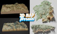
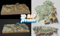
Hello and welcome to my gig
Looking for a 3D map that turns raw elevation data into a stunning visual? I design custom 3D shaded relief maps, terrain models, and topography maps for print, digital display, CNC carving, gaming, real estate, education, and personal keepsakes.
What I can create for you:
Perfect for:
Whether you need a single mountain range, a national park, a ski resort, a coastline, or your entire hometown rendered in realistic 3D relief, I combine accurate elevation data (LiDAR/DEM sourced) with hand-tuned shading, color gradients, and labeling to create a map that's both s
Please inform the freelancer of any preferences or concerns regarding the use of AI tools in the completion and/or delivery of your order.
3d modelling, 3d sculpting, 3d printing
Level 1
Languages
What information do you need from me to get started?
Just the location or coordinates you want mapped, the intended use (wall art, CNC carving, presentation, etc.), preferred dimensions, and any style/color preference. Reference images are welcome but not required.
What file formats do I receive?
Standard delivery includes high-res PNG/JPG. STL, OBJ, or vector (AI/EPS) files for CNC/3D printing are available on Premium packages — let me know your intended use so I include the right format.
Can you map any location in the world?
Yes — as long as elevation data exists for the area (which covers virtually all of Earth's land surface), I can generate a relief map for it, from a single mountain to an entire region.
How accurate is the terrain data?
I source elevation data from LiDAR and DEM (Digital Elevation Model) datasets, so the terrain shape is scientifically accurate — not hand-drawn or estimated. Shading, color, and labeling are then custom-designed on top of that accurate base.
Can I request custom colors, labels, or a specific art style?
Absolutely. I can match a brand palette, go for a natural/realistic look, or create a stylized artistic relief — just share your preference and I'll tailor it.
How long does delivery take?
Turnaround depends on map complexity and package tier — exact delivery times are listed in each package. Rush delivery may be available on request.
Can this be used for CNC carving or 3D printing?
Yes — this is one of the most common uses. Let me know your machine/software requirements (e.g. STL file, specific resolution) so the file is properly prepared for fabrication.


