Browse categories
Explore
Fiverr Pro
English
$
USD
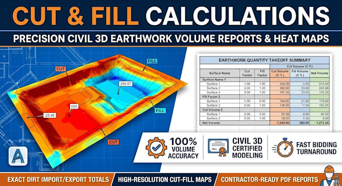
Are you looking for accurate cut and fill calculations and a professional Civil 3D grading report for your construction or bidding project?
I am a Civil Engineering CAD Specialist providing precise earthwork quantity takeoffs and site grading analysis. Using industry standard AutoCAD Civil 3D, I transform your site topographic survey and proposed grading plans into detailed volume reports to help you minimize dirt import/export costs.
What You Will Get:
Why Choose My Service?
Please contact me before ordering so we can discuss your site survey files and project scope!

Project scale:
Building
Building type:
Residential
•
Commercial
•
Industrial
Material speciality:
Concrete
•
Wood
Please inform the freelancer of any preferences or concerns regarding the use of AI tools in the completion and/or delivery of your order.
What file formats do you need to calculate cut and fill volumes?
For the most accurate calculations, CAD vector files (.DWG or .DXF) with elevation contours or spot shots are ideal. Scaled PDF survey drawings can also be processed.
Will I receive a visual layout showing where the cut and fill areas are located?
Yes! The Standard and Premium packages include a high-contrast Civil 3D color heat map showing exactly where soil needs to be excavated (cut) or added (fill).
: Can you help balance the cut and fill volumes on my site design?
Absolutely! If your goal is a balanced mass haul (zero net import/export), I can analyze and suggest elevation adjustments to optimize earthwork quantities.
