Browse categories
Explore
Fiverr Pro
English
$
USD

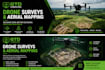
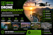

I offer high-quality, reliable drone surveying services tailored to meet your project needs. I capture accurate aerial data for a wide range of applications, including land surveying, construction monitoring, real estate, agriculture, roof inspections and site inspections as well aerial photography.
With a strong focus on precision and efficiency, I deliver detailed high-resolution imagery to help you make informed decisions. Whether you need progress tracking on a construction site or a full aerial survey of large land areas, I ensure fast turnaround times and professional results.
Safety, compliance, and data accuracy are my top priorities. Every project is handled with careful planning and attention to detail to ensure you receive dependable and actionable insights.
Lets work together to bring a new perspective to your project from above.
Cork (Munster Area Only)
IT Support
Languages


