Browse categories
Explore
Fiverr Pro
English
$
USD

Level 1


I will create orthomosaics and 3D models from drone images
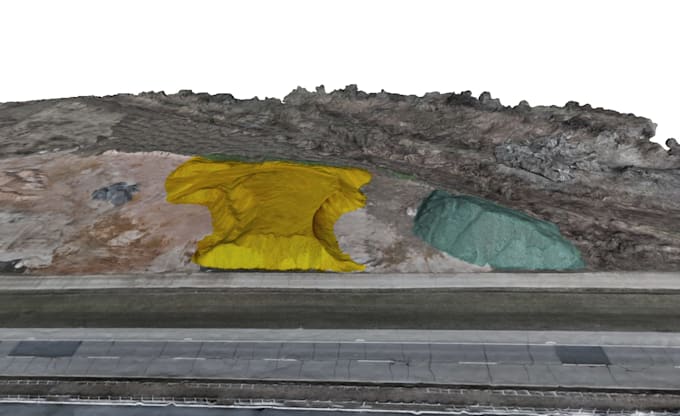
Turn your drone images into accurate maps and 3D models for engineering and surveying.
Orthomosaics (georeferenced)
3D models & point clouds
DEM / DSM
Volume calculations
Ideal for construction, mining, and land development projects.
Send me your images and project details before ordering.
Please inform the freelancer of any preferences or concerns regarding the use of AI tools in the completion and/or delivery of your order.
Topographic engineer
Level 1
Languages