Browse categories
Explore
Fiverr Pro
English
$
USD

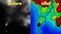

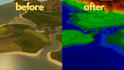
Looking for accurate DTM (Digital Terrain Model) creation from various sources?
I specialize in transforming raw data into high-quality terrain models, contours, and grid layers for GIS, simulation, and design projects.
What I Offer:
Why Choose Me?
Lets turn your raw data into a professional terrain model! Feel free to contact me before placing an order to discuss your project requirements.
Survey Processor
Languages
What type of data can you use to create a DTM?
I can work with LiDAR data, satellite images, contour files, hand sketches, game screenshots, and CAD drawings. If you have any other format, feel free to ask!
What file formats will I receive?
I can provide grid layers (ASCII, GeoTIFF), contour files (DXF, SHP, KML) and CAD drawings. Let me know your preferred format!
Can you create a DTM if I don’t have real-world data?
Yes! I can generate a custom or synthetic DTM based on your design, concept, or required topography. This is useful for simulations, gaming, and planning.
How accurate is the terrain model?
The accuracy depends on the quality of the source data. If you provide LiDAR or high-resolution satellite imagery, I can generate a highly accurate model.


