Browse categories
Explore
Fiverr Pro
English
$
USD
Cold Calling Content Writer Virtual Assistant
Hi, Im Hafsa, a Space Science graduate from the Institute of Space Technology (Islamabad) and a published researcher in planetary remote sensing.
I do professional GIS mapping and spatial analysis using ArcGIS, QGIS, and JMARS. I have hands-on experience analyzing HiRISE, CTX, and THEMIS satellite data and processing high-resolution Digital Elevation Models (DEMs) to study terrain, slope, aspect, and curvature.
What I can help with:
Perfect for students, researchers, and small businesses.
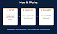
Please message me before ordering so I can confirm your data and requirements. I reply quickly and deliver on time.


Technology:
Jupyter Notebook
•
MATLAB
•
arcgis
•
Pandas
Analysis type:
Quantitative analysis
•
Qualitative analysis
Programming language:
R
•
MATLAB
•
C++
Which software do you use?
I use ArcGIS, QGIS, and JMARS. You’ll receive the final maps (PNG/PDF), the project files, and a short report explaining the results.
Can you work with my own data?
Yes. Send me your shapefiles, rasters, or DEMs. If you don’t have data yet, I can source open satellite data (like Landsat, Sentinel, or HiRISE) for your area of interest.
What do you need from me to get started?
Please share your project goal, the area you want mapped, any data you already have, and your preferred output format. Message me before ordering and I’ll confirm everything.


