Browse categories
Explore
Fiverr Pro
English
$
USD

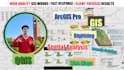
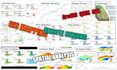
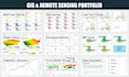

I am a PhD student in Geographic Information Science. I have studied and used GIS tools for 9 years, including ArcGIS, ArcGIS Pro, QGIS, Google Earth, Google Earth Engine, Google Earth Studio, and Google Maps.
I can help you create clear GIS maps, remote sensing results, and spatial analysis outputs for research, reports, planning, agriculture, environment, hydrology, climate, and land use projects.
My services include:
You can send me shapefiles, rasters, Excel/CSV data, KML files, coordinates, satellite images, or study area details.
You will receive high-quality maps in PNG, JPG, PDF, or GIS formats. Editable source files can also be included if needed.
Please contact me before placing an order so I can check your data and suggest the best package.
GIS, Remote Sensing Specialist, Spatial Analysis, WebGIS, Website Developer
Languages
What do you need to start?
I need your project objective, study area, data files or download links, preferred output format, deadline, and any required map style or analysis method.
Can you work if I do not have GIS data?
Yes. I can help identify open data sources when possible, such as administrative boundaries, elevation, land use, satellite imagery, climate data, or OpenStreetMap data. Please message me first so I can confirm availability.
Which tools can you use?
I can work with QGIS, ArcGIS-style workflows, Google Earth/KML, Python geospatial libraries, raster/vector formats, and spreadsheet-based coordinate data.
Can you do remote sensing analysis?
Yes. I can support raster processing, vegetation and land cover analysis, salinity or environmental mapping, multi-year change analysis, classification, and satellite-derived mapping workflows.
Can you make maps for a thesis, paper, or report?
Yes. I can create clean, publication-ready maps and figures with legends, scale bars, north arrows, labels, consistent colors, and high-resolution export.
Are editable source files included?
Source files can be included in the Standard and Premium packages, or added to the Basic package as an extra. Please tell me which format you need.
Can you handle urgent work?
Small maps may be delivered quickly, depending on data quality and scope. Please contact me before placing an urgent order.
Should I contact you before ordering?
Yes. GIS projects vary a lot by data quality, study area, and analysis method. A short message helps me recommend the right package and avoid delays.


