Browse categories
Explore
Fiverr Pro
English
$
USD


I'm Hammam Abdelmajed, a GIS & Mapping Expert with 4+ years of experience, specializing in interactive maps, geospatial applications, and location-based solutions.
Have Experience
Mapping & GIS Technologies:
Leaflet JS, OpenLayers JS, Mapbox GL JS, MapLibre GL JS, Cesium JS
Google Maps API, OpenStreetMap, Carto
ESRI JS API, ArcGIS Online
Frontend & Backend Development:
React JS, Angular
.NET Core, Node JS, Express JS, Laravel, CodeIgniter, Python Django
GIS & Spatial Databases:
GDAL, PostGIS, PostgreSQL, MongoDB
Geoserver, Mapserver, ESRI Server
Rasterio, Geopandas
I Offer the Following Services:
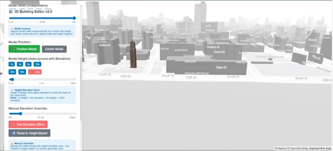
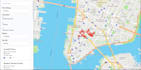
GIS & Spatial Mapping Custom interactive maps, spatial data visualization
Remote Sensing & Satellite Imagery Processing and analysis
Geospatial Web Application Development Custom mapping apps
Data Conversion & Custom Server Installation Geospatial data processing
⭐ Why Choose Me?
Long-Term Relationship & Support Reliable and ongoing assistance
Fast Delivery Ensuring projects are completed on time
For custom orders, inbox me for more details!
Software Engineer
Languages
What information do you need from me to get started ?
You’ll need to provide your geospatial data (or data sources), project objectives, target users, preferred mapping platform (if any), and hosting details. Without clear data and use cases, timelines and accuracy will suffer.
Can you work with my Existing GIS Data and Systems ?
Yes. I work with most GIS formats and platforms (Shapefiles, GeoJSON, raster data, PostGIS, ESRI, GeoServer, APIs). If your data is messy or inconsistent, cleanup and optimization may be required and will be scoped separately.
Do you deliver only Maps or full geospatial application ?
Both. I build simple interactive maps as well as full-scale geospatial web applications with backend services, databases, user roles, and analytics—depending on your requirements and budget.
How do you handle performance for large datasets or high traffic ?
Large datasets are handled using spatial indexing, tiling, clustering, caching, and optimized databases (PostGIS, GeoServer, MapServer). Performance planning is done upfront to avoid scaling issues later.
Do you Deliver post-delivery support and maintenance ?
Yes, but it’s not assumed. Ongoing support, updates, server maintenance, or data refreshes are offered under a separate agreement after project delivery