Browse categories
Explore
Fiverr Pro
English
$
USD


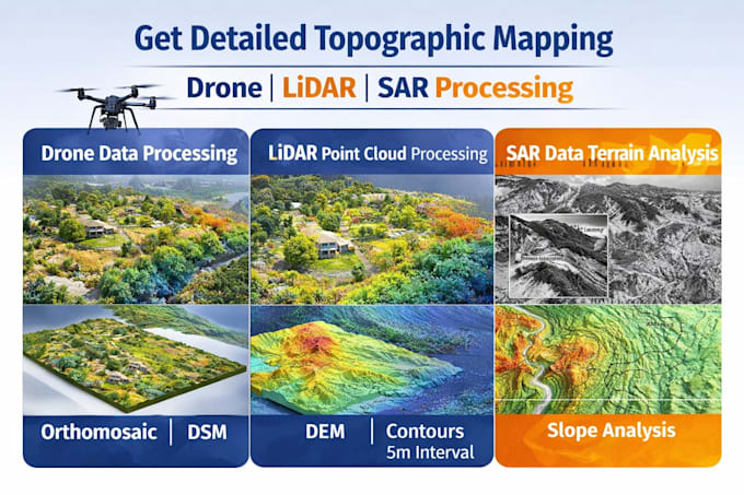
Are you looking for accurate and professional topographic maps from drone, LiDAR, or SAR data? Youre in the right place!
I am a GIS Specialist with expertise in processing geospatial data to create high-quality terrain models and maps for engineering, environmental, and planning projects.
What I offer:
Tools I Use:
Why choose me?
NOTE: PLEASE CONTACT BEFORE PLACING AN ORDER.
Analyzing and Visualizing Spatal Data
Languages
1. What type of data do you need to start the project?
I need your drone images, LiDAR (LAS/LAZ), or SAR data, along with your project requirements (area, output type, and format).
2. What outputs will I receive?
You can get: DEM (Digital Elevation Model) DSM (Digital Surface Model) Contour maps Slope & terrain analysis Orthomosaic (from drone data) GeoTIFF, Shapefile, KML, or other formats
3. Can you process large datasets?
Yes, I can handle small to large datasets. For very large projects, please contact me first for a custom offer.
4. Can you customize the analysis based on my project?
Absolutely! I can tailor outputs like contours, slope classes, hillshade, or terrain models based on your needs.
5. Do you provide accurate and professional results?
Yes, I use industry-standard GIS tools and workflows to ensure high accuracy and reliable outputs.