Browse categories
Explore
Fiverr Pro
English
$
USD


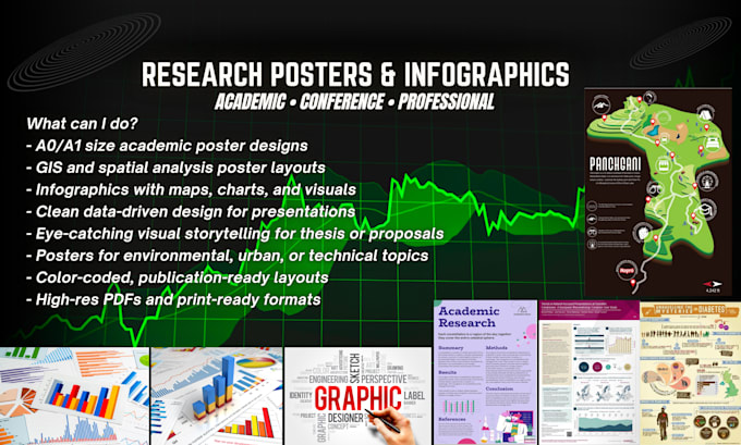
Research Posters and Infographics->
Hey there!
I'm Hamza, a GIS and research communication expert with a passion for visual design!
⭕ Presenting at a conference or seminar?
⭕ Need a scientific or technical poster that stands out?
⭕ Want to visualize your GIS or research data beautifully?
You're in the right place!
What can I do?
- A0/A1 size academic poster designs
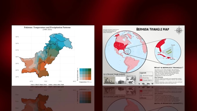
- GIS and spatial analysis poster layouts
- Infographics with maps, charts, and visuals
- Clean data-driven design for presentations
- Eye-catching visual storytelling for thesis or proposals
- Posters for environmental, urban, or technical topics
- Color-coded, publication-ready layouts
- High-res PDFs and print-ready formats
Why me?
- 6+ years in GIS, planning, and report writing
- Expert in Canva, Illustrator, and infographic design
- Customized styles based on your audience
- Fast delivery, unlimited revisions, total quality focus!
Lets make your research unforgettable:
1. Send me your topic, content, and visual preferences
2. Ill design a layout that's clear and beautiful
3. Final file in PDF, JPEG, or PNG-ready to present or print!
Note:
Always message me first to align on topic
Please inform the freelancer of any preferences or concerns regarding the use of AI tools in the completion and/or delivery of your order.
GIS Expert and Spatial Planner
Languages
Can you help with layout and content flow?
Yes, I’ll guide you on structuring your poster for maximum clarity and impact.
Do you work with scientific, environmental, or planning topics?
Absolutely! Those are my specialties, including GIS and urban data.
What format will the poster be in?
PDF for print, plus optional JPEG or PNG for digital use.
| (1) | ||
| (0) | ||
| (0) | ||
| (0) | ||
| (0) |
sami32st

United States
Real pro pleasure to work with you
$50-$100
Price
2 days
Duration
| (1) | ||
| (0) | ||
| (0) | ||
| (0) | ||
| (0) |
sami32st
United States
Real pro pleasure to work with you
$50-$100
Price
2 days
Duration